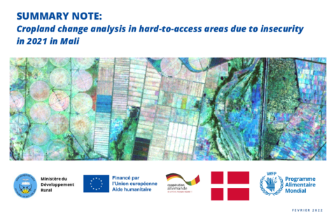
To better understand the impact of insecurity on cropland
dynamics, the World Food Programme (WFP) in collaboration
with the Ministry of Rural Development (MDR) and the
involvement of technical services and partners: AGIR Cell,
CPS/SDR, DNA, DRA (Gao, Timbuktu, Mopti and Segou),
INSTAT, IGM, DNGR, Mali-Météo, USSGB, IER, GIZ, IPRODI
have undertaken in October 2021 the analysis based on
satellite images to observe and detect the dynamics of
agricultural surfaces. Indeed, satellite imagery has
proven to be an effective and innovative tool to obtain
information in these difficult-to-access areas.
By detecting the physical impacts of the conflict, such as the reduction, disappearance and/or increase of crops, this analysis provides an overview of the situation at the end of the 2021 agricultural season and enables to identify the most affected and vulnerable areas in Mali.